
Welches ist das gebräuchlichste Gerät zur Landvermessung?
Grundlagen der Landvermessungsgeräte
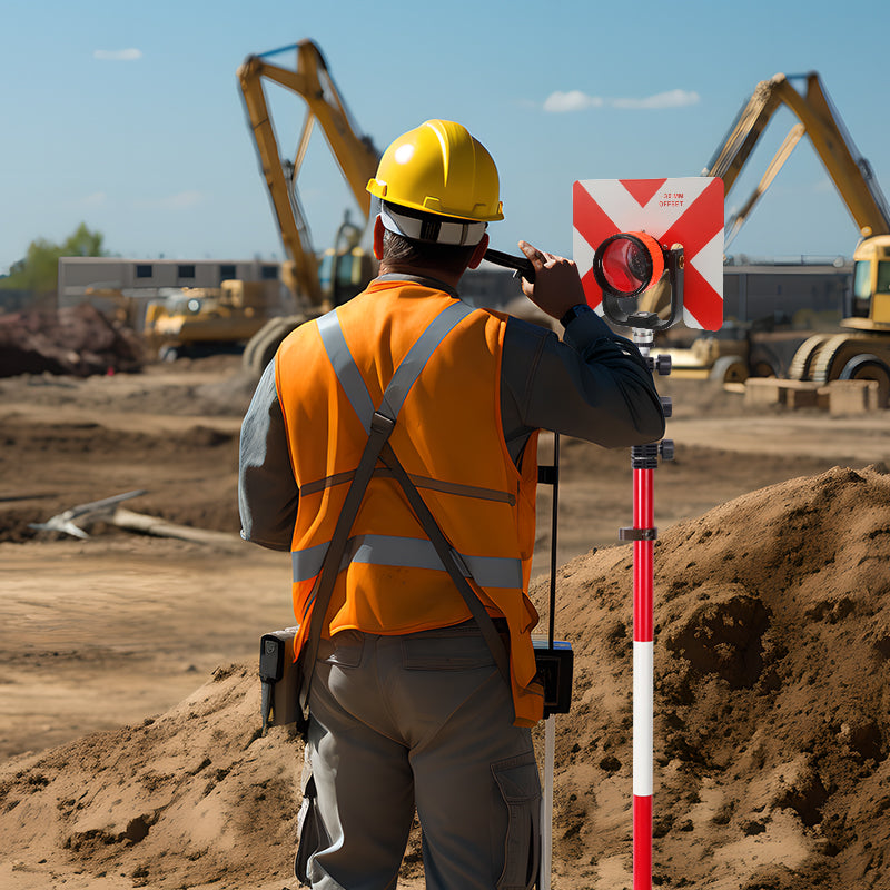
Vermessungsgeräte sind unerlässlich für die präzise Messung und Kartierung der Erdoberfläche. Sie umfassen eine breite Palette an Werkzeugen und Geräten, die Vermesser zur Datenerfassung, Grenzfestlegung und Durchführung verschiedener räumlicher Messungen einsetzen. Von Bauprojekten bis hin zu Grundstücksstreitigkeiten spielen die Genauigkeit und Zuverlässigkeit der Vermessungsgeräte eine entscheidende Rolle für präzise Ergebnisse. Unter den vielfältigen verfügbaren Vermessungsgeräten sticht die Totalstation als das gebräuchlichste und vielseitigste Instrument im Gelände hervor.
Gängige Landvermessungsgeräte
1. Totalstation
Die Totalstation ist wohl das am weitesten verbreitete Vermessungsgerät. Sie vereint die Funktionen eines elektronischen Theodoliten und eines elektronischen Distanzmessers (EDM) in einem einzigen Gerät. Diese Kombination ermöglicht präzise Winkel- und Entfernungsmessungen. Moderne Totalstationen verfügen über Datenspeicher- und -verarbeitungsfunktionen und sind daher für vielfältige Vermessungsaufgaben äußerst effizient. Sie werden für Grenzvermessungen, topografische Vermessungen und Bauabsteckungen eingesetzt. Die Vielseitigkeit, Genauigkeit und die Möglichkeit der elektronischen Datenspeicherung machen die Totalstation für Vermesser unverzichtbar.
2. GPS-Vermessungsgeräte
GPS-Vermessungsgeräte sind ein weiteres gängiges Werkzeug in der Landvermessung. Sie bestimmen die genaue Position eines Punktes auf der Erdoberfläche durch den Empfang von Satellitensignalen. Sie bieten hohe Genauigkeit für großflächige Vermessungen und sind unverzichtbar für geodätische und Katasterarbeiten. Moderne GPS-Systeme verfügen oft über die Echtzeitkinematik (RTK), die die Genauigkeit weiter verbessert und besonders für hochpräzise Anwendungen wie Bauwesen und Kartierung von Nutzen ist.

3. Laserscanner
Laserscanner erfassen detaillierte dreidimensionale Daten von Objekten und Umgebungen. Sie funktionieren, indem sie Laserstrahlen aussenden und die Laufzeit der Strahlen messen. So entsteht eine Punktwolke, die den gescannten Bereich repräsentiert. Diese Geräte sind wertvoll für die Erstellung detaillierter 3D-Modelle von Gelände, Gebäuden und Bauwerken. Laserscanning ist besonders nützlich bei archäologischen Untersuchungen, der Architekturdokumentation und großen Infrastrukturprojekten.

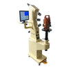
4. Nivellierinstrumente
Nivelliergeräte wie optische und digitale Nivelliergeräte dienen der Messung vertikaler Distanzen und der Bestimmung von Höhenunterschieden zwischen Punkten. Diese Geräte sind unerlässlich für die Erstellung präziser topografischer Karten und die korrekte Nivellierung von Bauprojekten. Optische Nivelliergeräte basieren auf traditionellen optischen Messverfahren, während digitale Nivelliergeräte eine höhere Präzision und Automatisierung bieten.
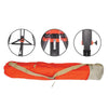
5. Theodolite
Theodolite sind traditionelle Vermessungsinstrumente zur Messung horizontaler und vertikaler Winkel. Obwohl sie aufgrund der Einführung von Totalstationen in der modernen Vermessung weniger gebräuchlich sind, werden sie weiterhin für bestimmte Anwendungen und im Bildungsbereich eingesetzt. Theodolite sind bekannt für ihre Präzision und Zuverlässigkeit bei Winkelmessungen.
Landvermessungsgeräte: Besondere Merkmale und Innovationen
Die Vormachtstellung der Totalstation im Bereich der Landvermessungsgeräte lässt sich auf mehrere einzigartige Merkmale und Innovationen zurückführen:
Integrierte Technologie: Totalstationen kombinieren Winkel- und Entfernungsmessung in einem Gerät, wodurch der Vermessungsprozess vereinfacht und der Bedarf an mehreren Instrumenten reduziert wird.
Datenverarbeitung und -speicherung: Moderne Totalstationen sind mit fortschrittlicher Software zur Datenverarbeitung ausgestattet, die es Vermessern ermöglicht, Berechnungen und Analysen direkt vor Ort durchzuführen.
GPS-Integration: Einige Totalstationen verfügen über eine GPS-Integration, die die Genauigkeit erhöht und Geodaten für umfassende Vermessungen liefert.
Laserscanner haben auch bedeutende Innovationen hervorgebracht:
Hochauflösende 3D-Kartierung: Laserscanner bieten detaillierte 3D-Kartierungsfunktionen, erfassen selbst feinste Details und liefern wertvolle Daten für komplexe Projekte.
Effizienz: Sie können große Gebiete schnell scannen und sparen so Zeit im Vergleich zu herkömmlichen Vermessungsmethoden.

Bei der Auswahl von Vermessungsgeräten sollten folgende Faktoren berücksichtigt werden:
Genauigkeit: Stellen Sie sicher, dass die Ausrüstung die Präzisionsanforderungen für Ihre spezifischen Vermessungsaufgaben erfüllt.
Funktionalität: Wählen Sie Geräte, die Ihren Vermessungsanforderungen entsprechen, sei es zur Grenzbestimmung, topografischen Kartierung oder 3D-Modellierung.
Benutzerfreundlichkeit: Berücksichtigen Sie den Lernaufwand und die Benutzerfreundlichkeit des Geräts, insbesondere wenn es von mehreren Benutzern bedient wird.
Support und Service: Entscheiden Sie sich für Geräte von renommierten Herstellern, die zuverlässigen Support und Service bieten.
Wenn Sie nach „Vermessungsgeräten in meiner Nähe“ suchen, ist es wichtig, einen Anbieter zu wählen, der für Qualitätsprodukte und guten Kundenservice bekannt ist. Mountlaser ist ein renommierter Hersteller von Vermessungsgeräten und bietet eine breite Produktpalette sowie exzellenten Service. Das Unternehmen liefert modernste Geräte und genießt hohes Ansehen für seine Expertise in diesem Bereich.
Abschluss
Zusammenfassend lässt sich sagen, dass die Totalstation das gebräuchlichste und vielseitigste Gerät für die Landvermessung ist und für ihre Integration von Winkel- und Entfernungsmessung, Datenverarbeitungsfunktionen und GPS-Integration bekannt ist.
Weitere wichtige Ausrüstungsgegenstände sind GPS-Systeme, Laserscanner, Nivelliergeräte und Theodolite, die jeweils spezifische Funktionen im Vermessungsprozess erfüllen. Bei der Auswahl von Vermessungsgeräten sollten Sie Genauigkeit, Funktionalität, Benutzerfreundlichkeit und zuverlässigen Support priorisieren. Für hochwertige Vermessungsgeräte empfiehlt sich Mountlaser, ein führender Hersteller, der für seine innovativen Lösungen und seinen exzellenten Kundenservice bekannt ist.