
Pourquoi choisir notre matériel de topographie ?
Le matériel topographique est essentiel aux professionnels de la construction, de l'ingénierie et de l'immobilier, car il leur fournit les outils nécessaires pour mesurer et cartographier les caractéristiques physiques de la Terre.
Ces instruments sont essentiels pour garantir la précision des projets, qu'il s'agisse de constructions à grande échelle ou de levés topographiques détaillés.
En tant que fournisseur Mountlaser, nous proposons une vaste gamme d'équipements topographiques conçus pour répondre aux besoins variés de nos clients. Cet article présente les avantages et les caractéristiques uniques de nos équipements, ainsi que les points clés à prendre en compte pour choisir les outils les mieux adaptés à vos projets.
Le matériel topographique comprend divers outils conçus pour mesurer et cartographier les caractéristiques physiques de la Terre.

1. Stations totales
Description : Combine un théodolite électronique et des fonctions de mesure de distance.
Utilisation : Utilisé pour des mesures précises d'angles et de distances en topographie.
2. Équipement de levé GPS
Description : Inclut des GPS portables et des systèmes GNSS plus avancés.
Utilisation : Fournit des données de positionnement et de navigation précises pour de vastes zones.
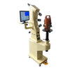
3. Instruments de nivellement
Description : Comprend des niveaux optiques et des niveaux numériques.
Utilisation : Permet de déterminer les différences de hauteur et d'établir des plans horizontaux.
4. Théodolites
Description : Instruments de mesure des angles horizontaux et verticaux.
Utilisation : Indispensable pour les travaux de triangulation et d'implantation.
5. Rubans et chaînes de mesure
Description : Outils simples pour les mesures linéaires.
Utilisation : Utilisé pour mesurer les distances dans diverses applications topographiques.
6. Fils à plomb
Description : Outils simples indiquant l'alignement vertical.
Utilisation : Utilisé pour établir des références verticales.
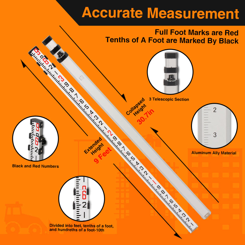
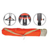
7. Mâts d'arpentage
Description : Tiges graduées utilisées avec des instruments de nivellement.
Utilisation : Utilisé pour mesurer les différences de hauteur lors du nivellement.
8. Collecteurs de données
Description : Appareils portables utilisés pour collecter et traiter les données d'enquête.
Utilisation : Interface avec d'autres équipements topographiques et stockage des données pour analyse.
9. Scanners laser
Description : Équipement utilisant des faisceaux laser pour capturer des données 3D.
Utilisation : Utilisé pour la cartographie et la modélisation topographiques détaillées.
10. Assemblages de prismes
Description : Dispositifs réfléchissants utilisés conjointement avec les stations totales.
Utilisation : Aide à la mesure précise des distances.

Ces outils permettent collectivement aux géomètres d'effectuer des mesures précises, de créer des cartes et de garantir l'exactitude des projets de construction et d'ingénierie.
Avantages des équipements de levés topographiques Mountlaser
1. Précision et exactitude
L'un des principaux atouts de notre matériel topographique réside dans sa précision. Nos instruments sont conçus pour fournir des mesures d'une grande exactitude, garantissant ainsi la fiabilité de vos levés. Que vous utilisiez des stations totales, des systèmes GPS ou des niveleurs, vous pouvez compter sur notre matériel pour obtenir des résultats d'une précision irréprochable.
2. Durabilité et fiabilité
Notre matériel topographique est conçu pour résister aux conditions de travail les plus difficiles. Fabriqués à partir de matériaux de haute qualité, ces outils sont résistants à l'usure, ce qui leur assure une longue durée de vie, même dans des environnements extrêmes. Cette robustesse vous garantit des performances constantes et réduit ainsi la fréquence des remplacements et des réparations.
3. Conception conviviale
Nous savons que la facilité d'utilisation est essentielle pour les professionnels du terrain. Nos appareils de topographie sont dotés d'interfaces intuitives et d'une conception ergonomique qui simplifient leur utilisation. Cette priorité accordée à l'expérience utilisateur permet aux géomètres de travailler efficacement, en réduisant le temps d'apprentissage et en optimisant leur productivité sur le terrain.
4. Technologie avancée
Chez Mountlaser, nous intégrons les technologies les plus récentes à nos équipements topographiques. Nos produits sont dotés de fonctionnalités innovantes telles que des écrans numériques, la connectivité Bluetooth et des systèmes automatisés d'acquisition de données. Ces avancées simplifient le processus de levé, permettant une acquisition de données plus rapide et plus précise.
Lors de l'achat de matériel topographique, plusieurs facteurs doivent être pris en compte afin de garantir un choix optimal pour vos besoins :
1. Exigences du projet
Tenez compte des exigences spécifiques de votre projet. Différents types d'enquêtes peuvent nécessiter différents équipements ; il est donc essentiel d'évaluer quels outils répondront le mieux à vos objectifs.
2. Budget
Établissez un budget qui concilie qualité et coût. Même s'il peut être tentant de choisir l'option la moins chère, investir dans du matériel topographique de haute qualité vous permettra de réaliser des économies à long terme en réduisant les coûts de maintenance et en améliorant la précision.
3. Réputation du fabricant
Renseignez-vous sur la réputation du fabricant. Privilégiez une marque reconnue pour sa fiabilité et son service client. Chez Mountlaser, nous sommes fiers de notre engagement envers la qualité et l'assistance, et nous veillons à ce que vous bénéficiiez d'une aide dès que vous en avez besoin.
Équipements de topographie répondant aux besoins du marché
Sur le marché actuel, de nombreux géomètres professionnels rencontrent des difficultés liées à l'obsolescence de leur matériel, au manque d'assistance et à la gestion complexe des données. Nos équipements topographiques répondent précisément à ces problématiques grâce à une technologie de pointe, un service client performant et une conception ergonomique qui simplifie le traitement des données. Investir dans nos outils vous permettra de surmonter les obstacles courants et d'optimiser vos compétences en topographie.

Conclusion
En résumé, notre matériel topographique offre une précision, une durabilité et une technologie de pointe exceptionnelles, ce qui en fait le choix idéal pour les professionnels du secteur. Grâce à des caractéristiques uniques, telles que des systèmes intégrés de gestion des données et des options respectueuses de l'environnement, nos produits se distinguent sur le marché. Si vous recherchez du matériel topographique de haute qualité, contactez Mountlaser dès aujourd'hui pour découvrir notre gamme de solutions innovantes. Votre prochain projet mérite les meilleurs outils !